SERVICES
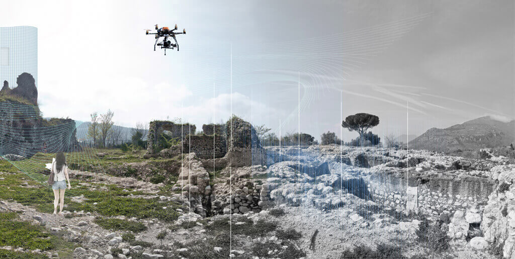
3D Mapping
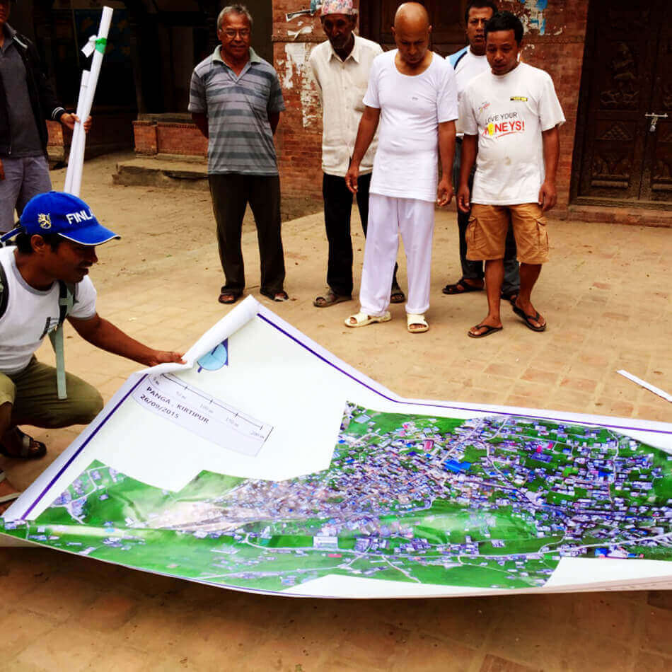
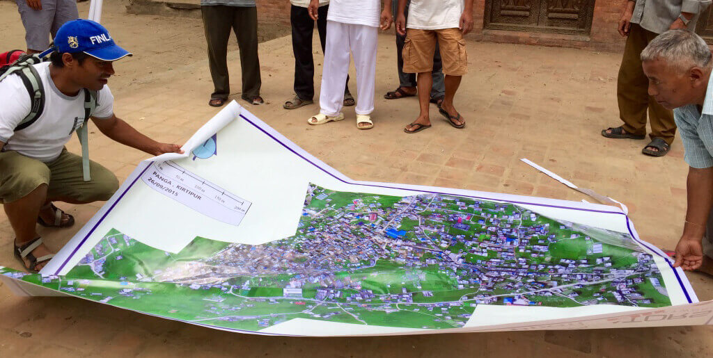
3D Mapping
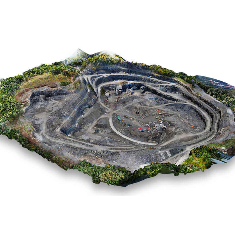

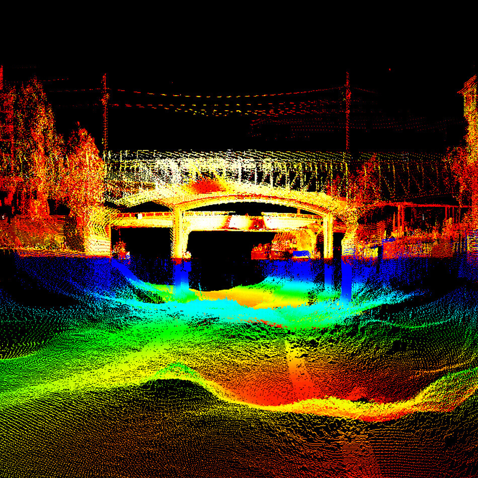
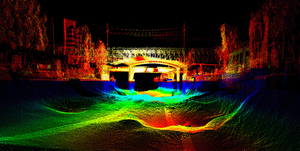
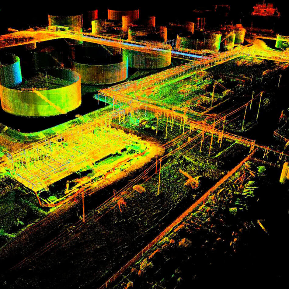
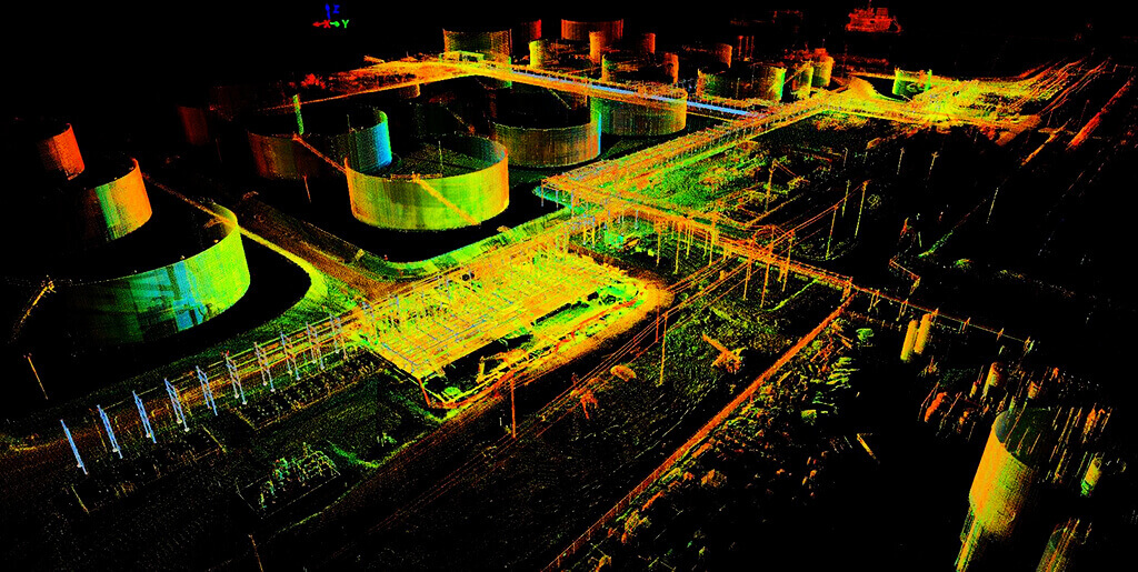
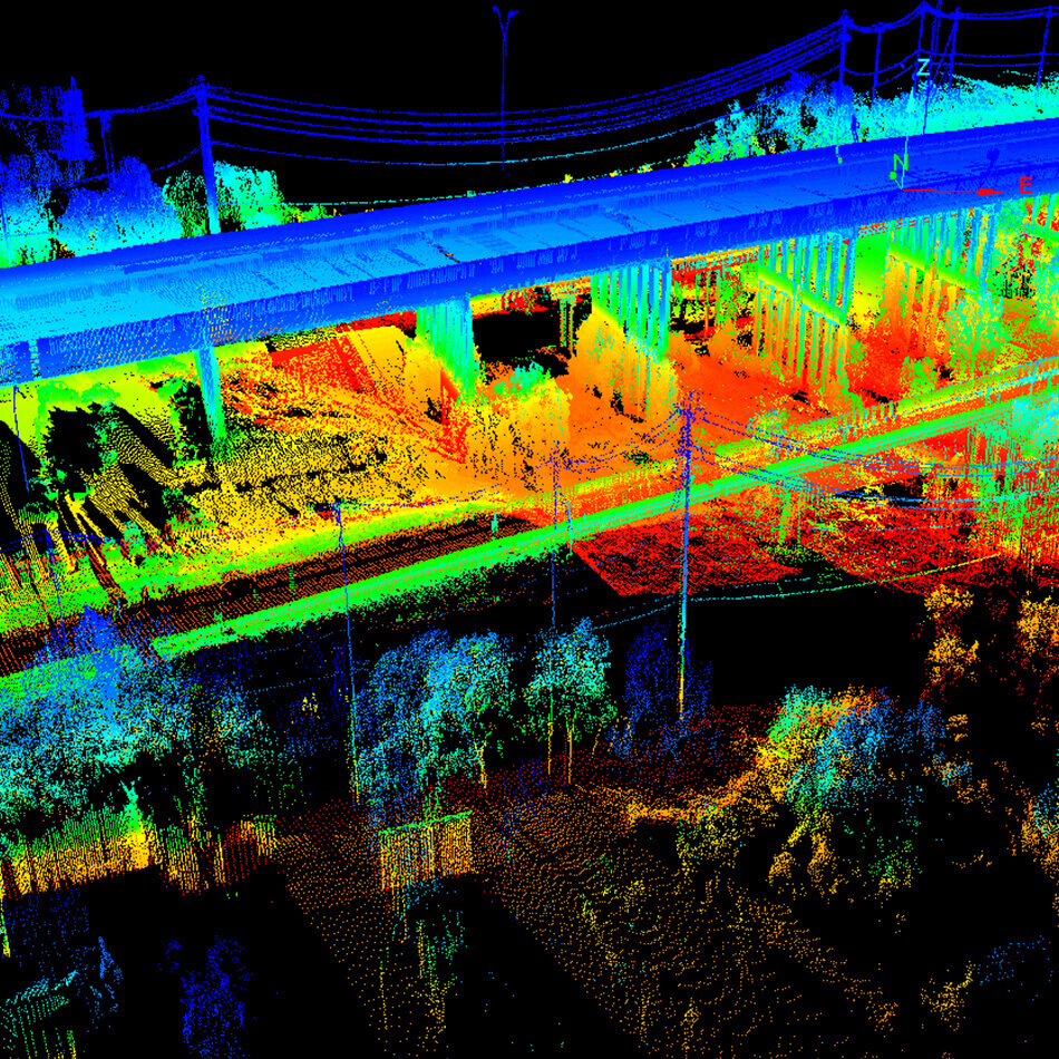
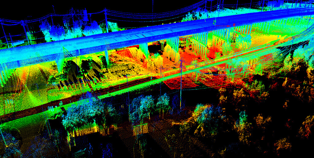
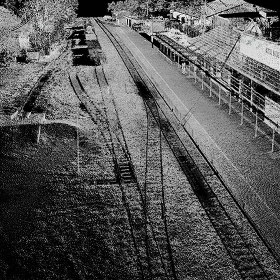
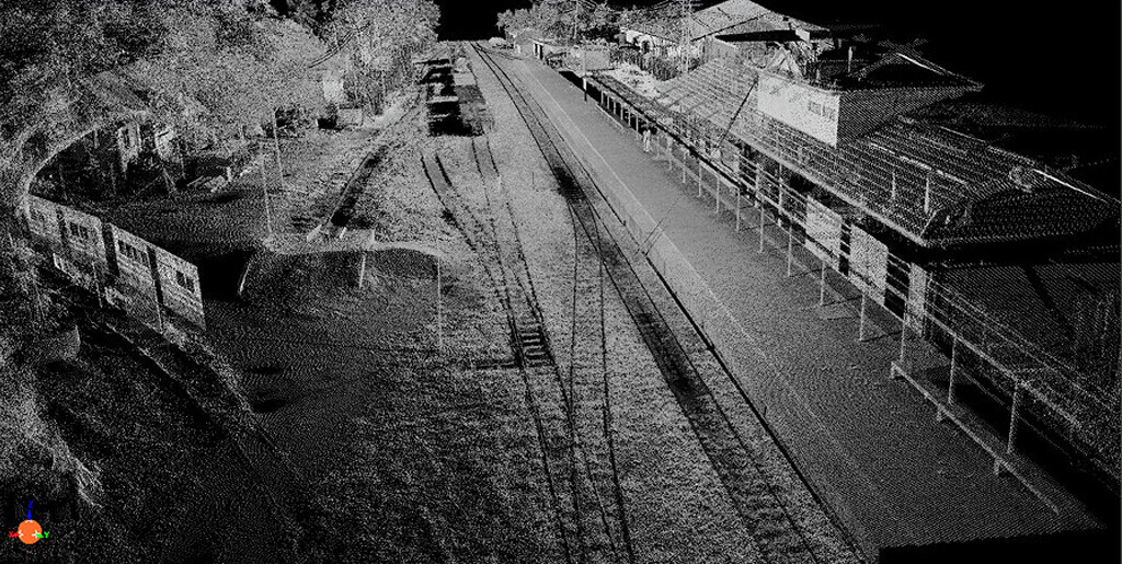
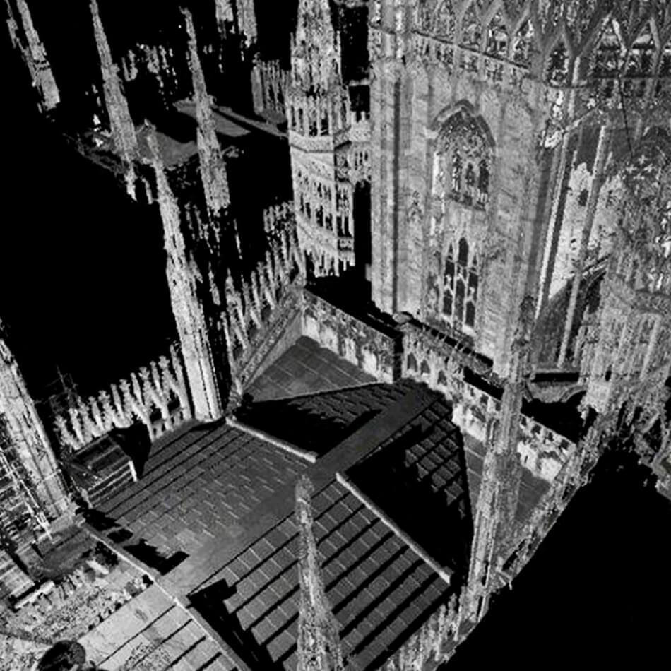
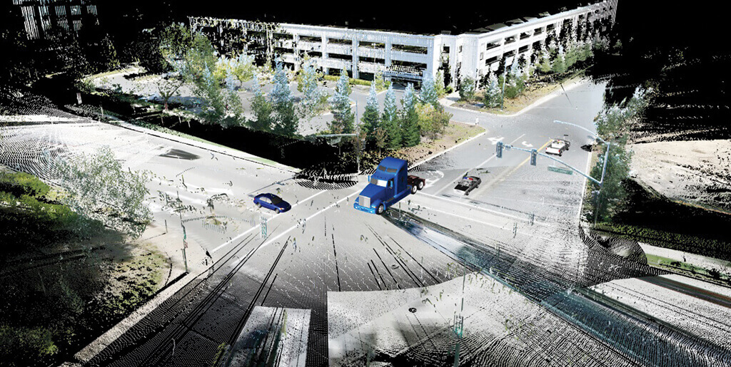
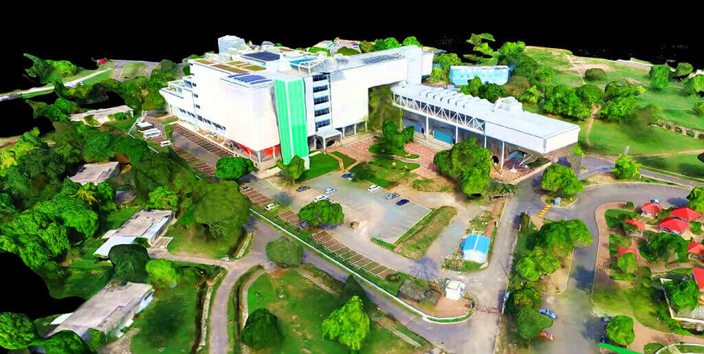
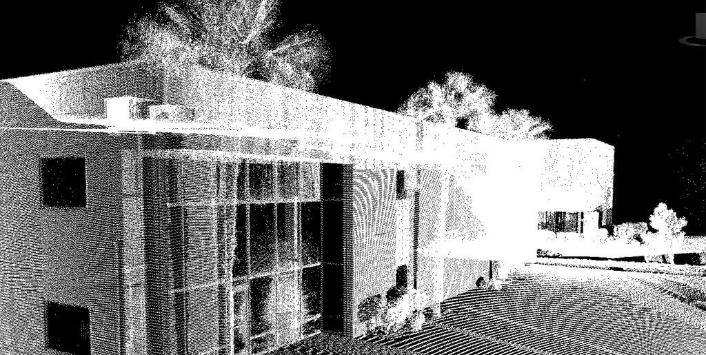
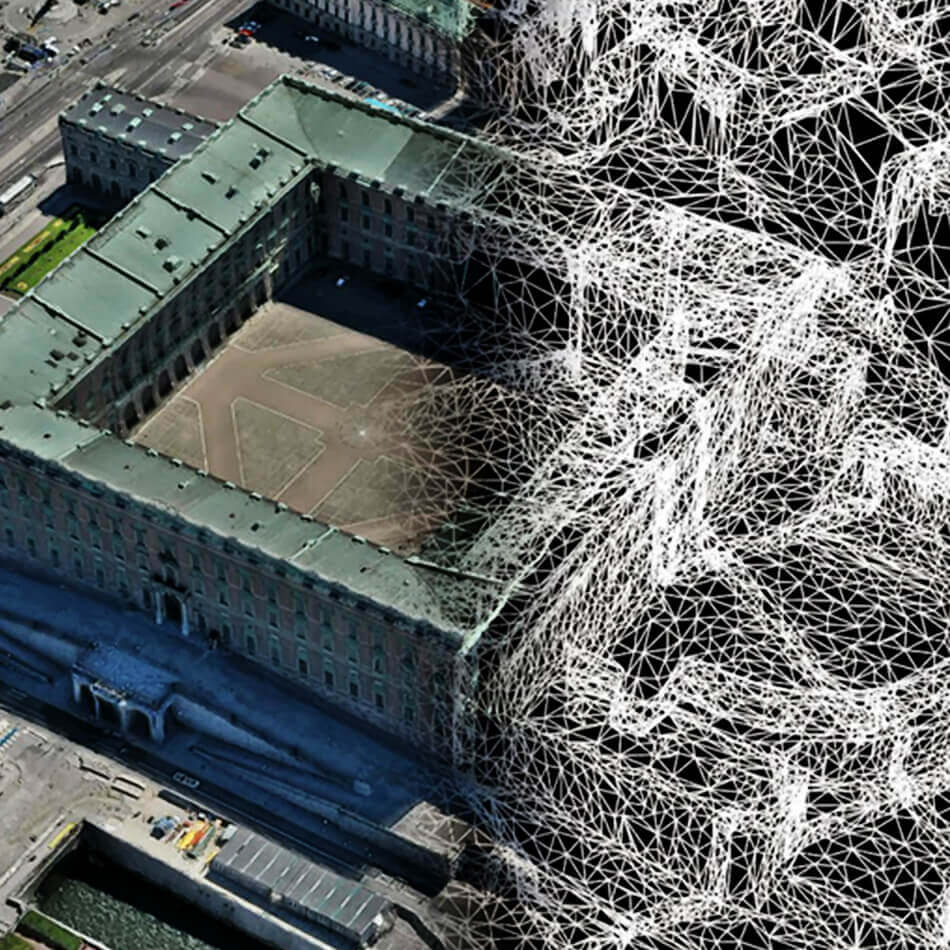
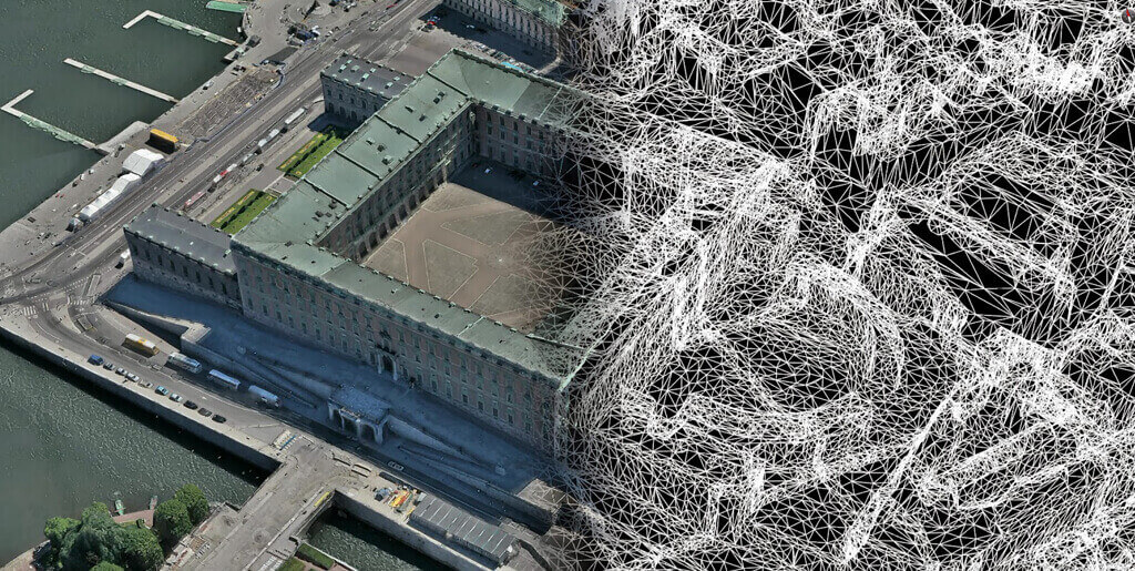
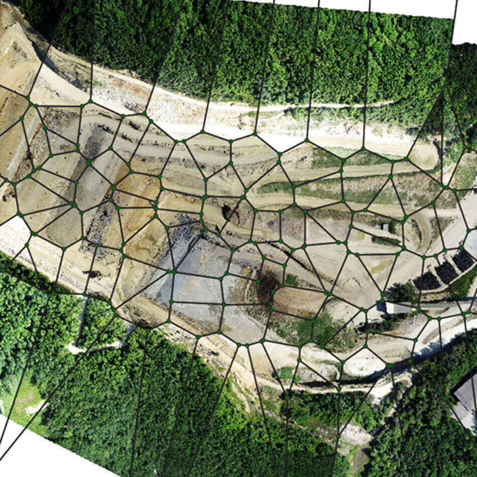
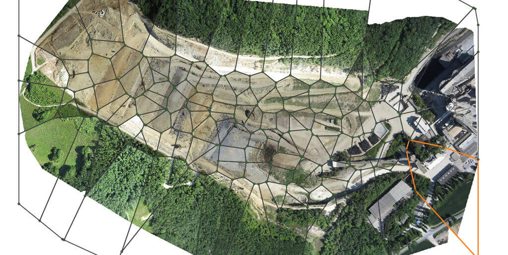
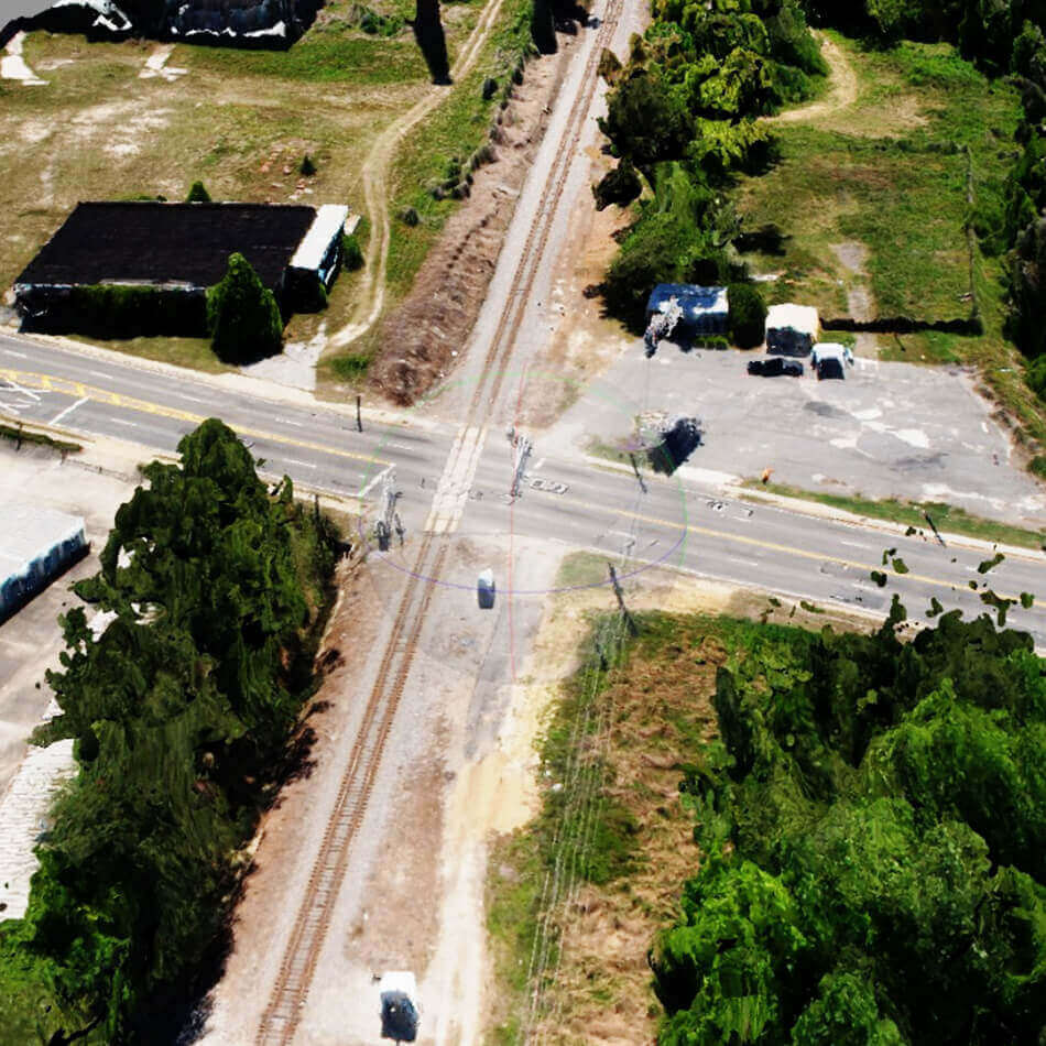
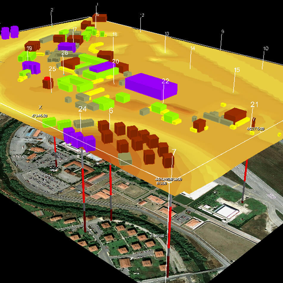
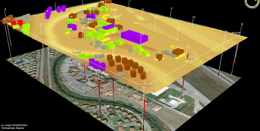
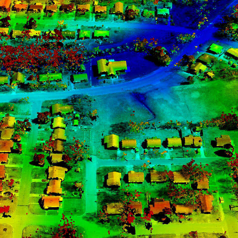
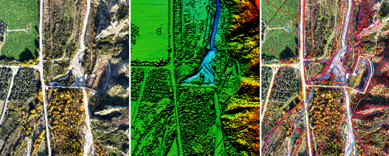
Image data in form of cluster of points having Latitude and Longitude coordinates. This is the base data to perform all measurement functions. Ground control points are necessary to get the desired accuracy.
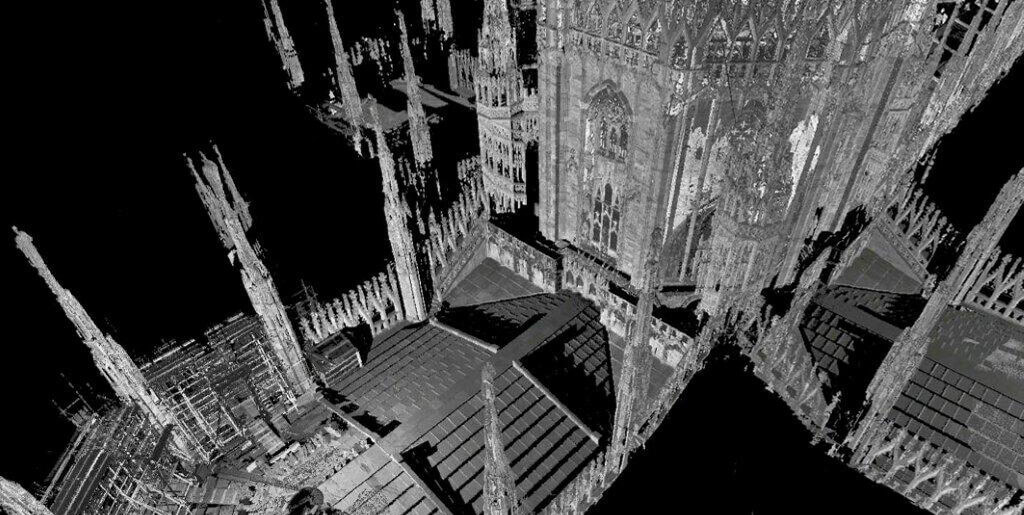
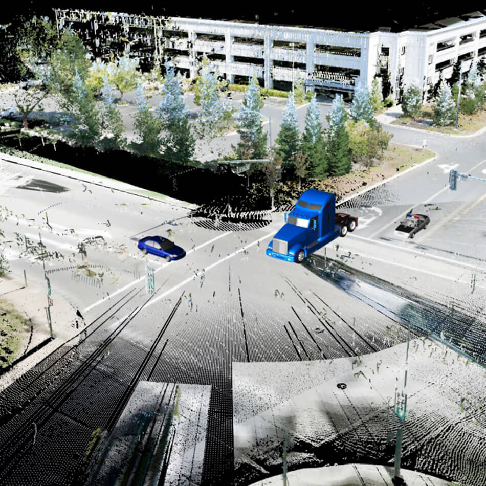
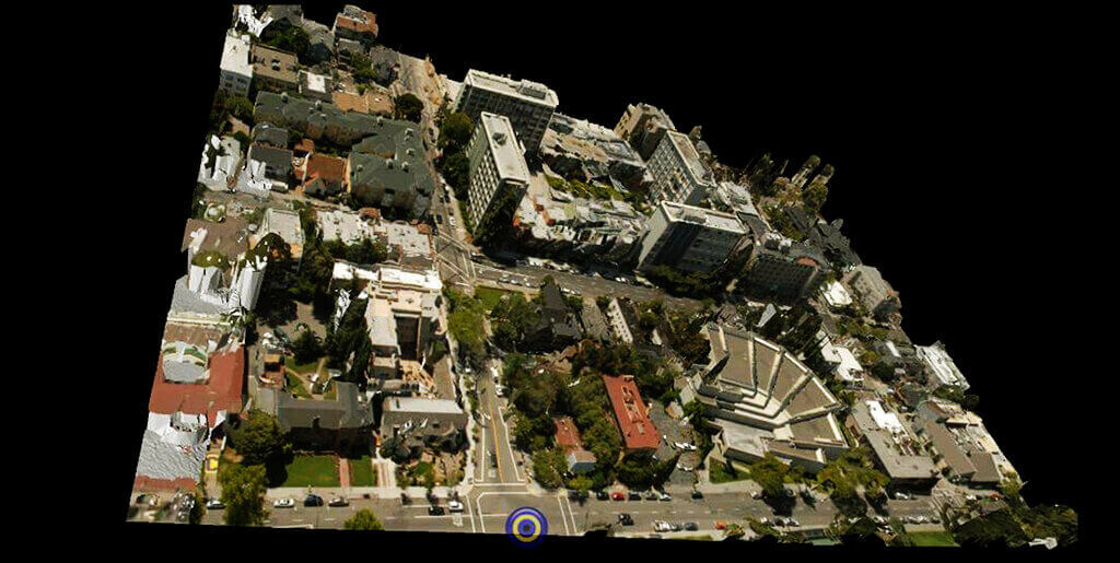
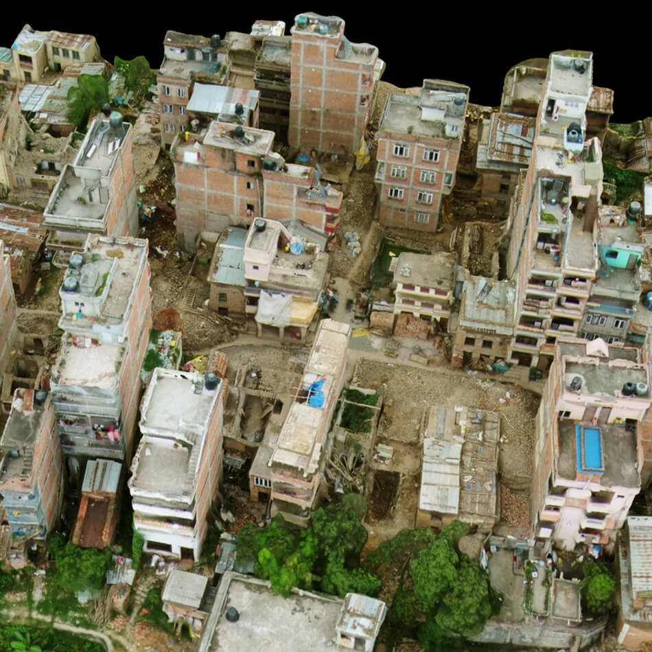
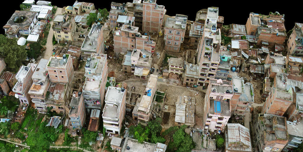
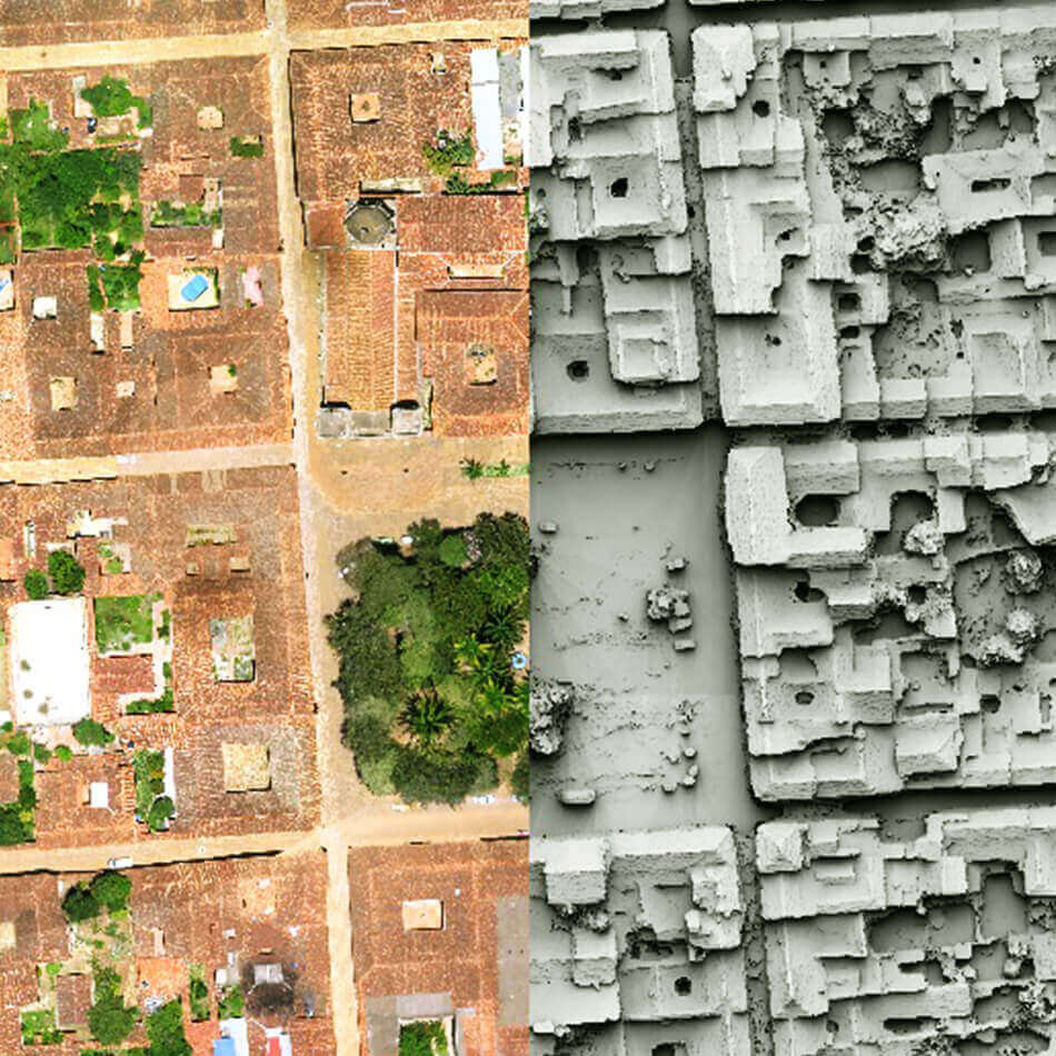
3D point clouds are used for many purposes, including to create 3D CAD models for manufactured parts, metrology/quality inspection, and a multitude of visualization, animation, rendering and mass customization applications. These are usually converted to polygon mesh or triangle mesh models, NURBS surface models, or CAD models so that they can be used directly for most 3D applications.
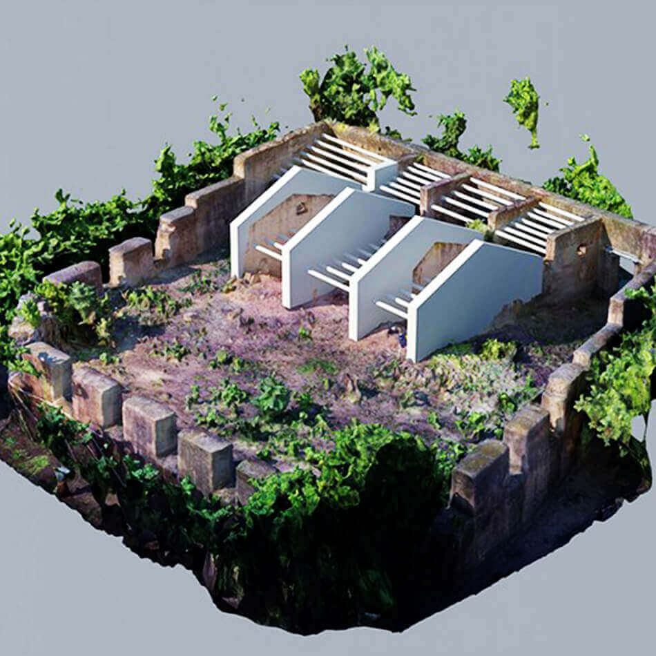
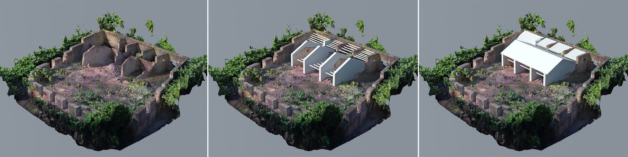
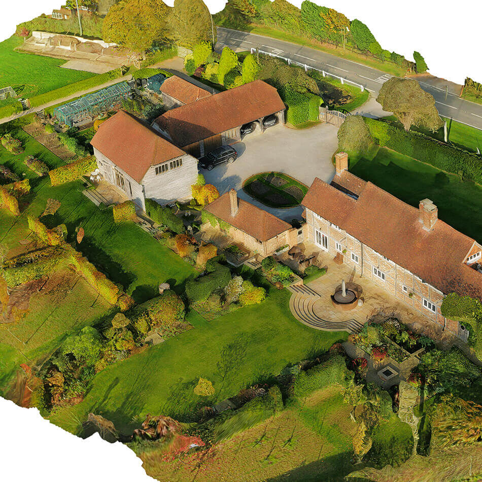
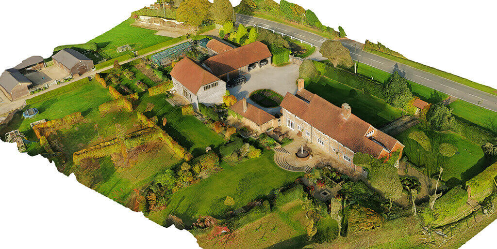
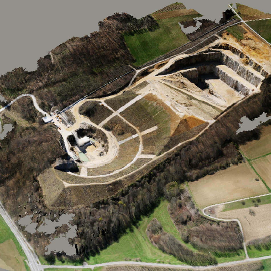
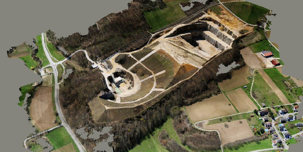
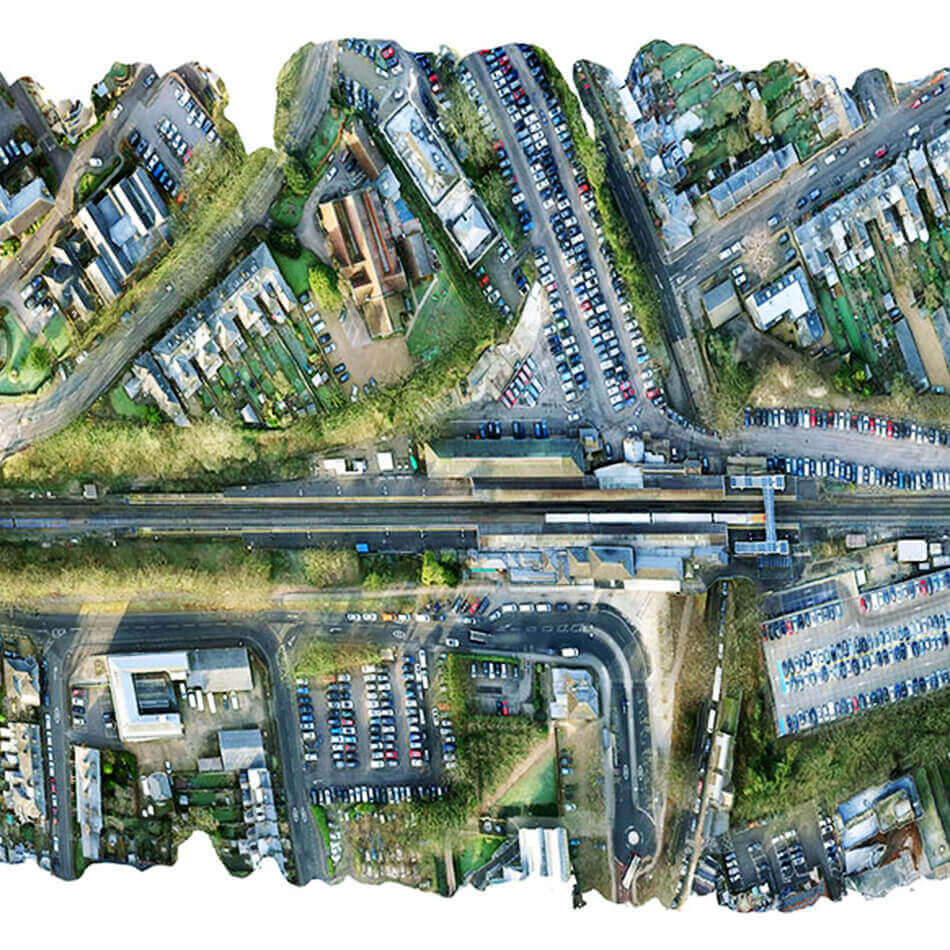
To create a surface that resembles real life you need to turn to texture mapping. 3D, texture mapping is the process of adding graphics to a polygon object. These graphics can be anything from photographs to original designs.
Textures can help age your object, and give them more appeal and realism. It helps in Accurate Measurements Vector Data and Height/Volume/Surface Area/Polyline Distance.
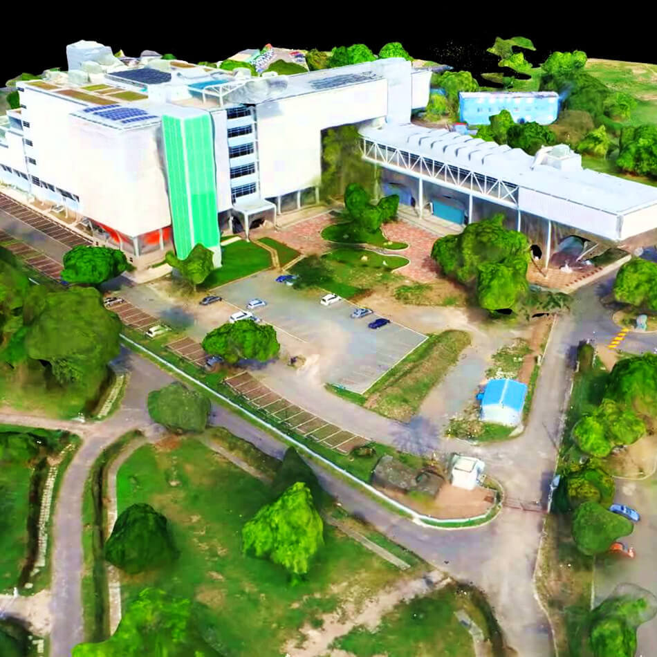
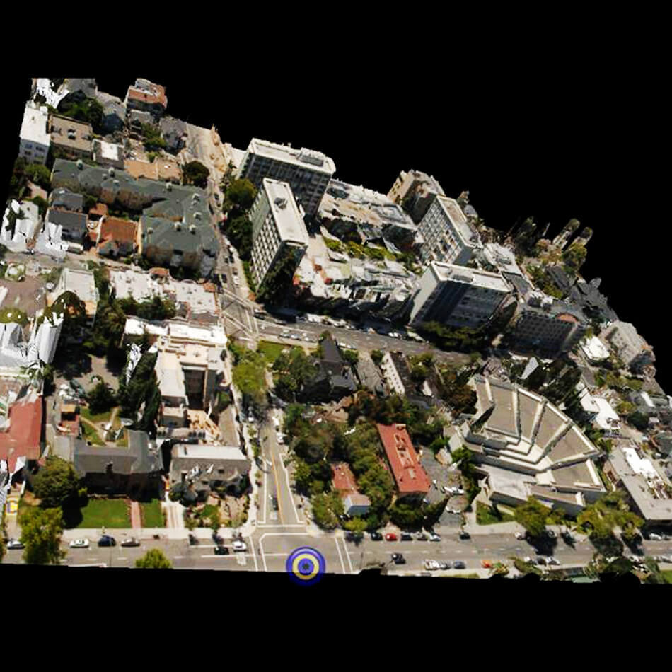
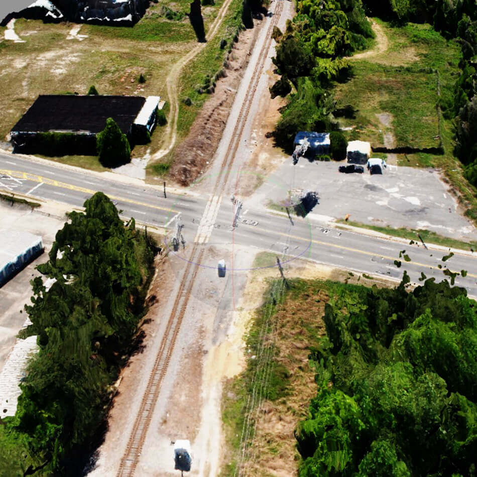
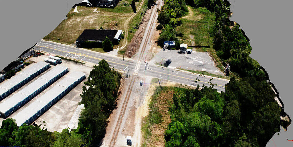
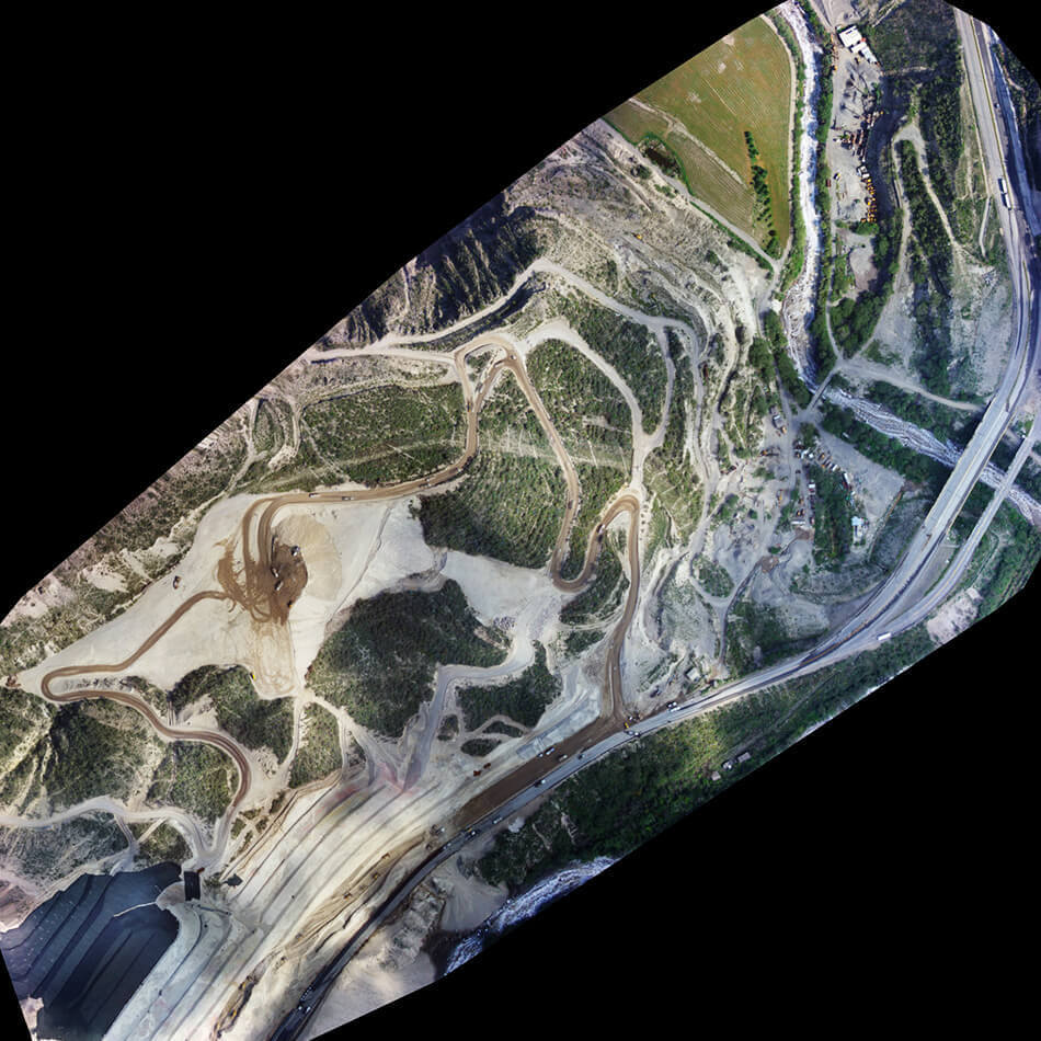
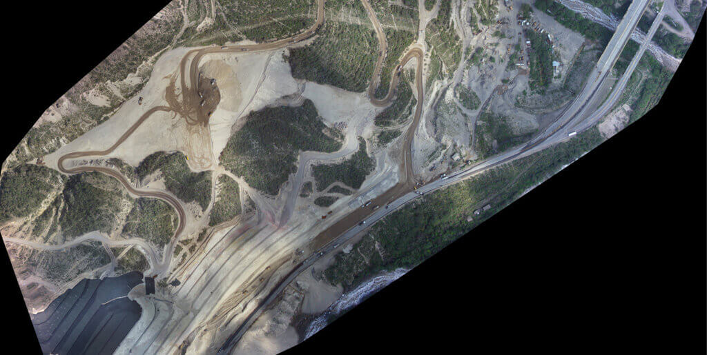
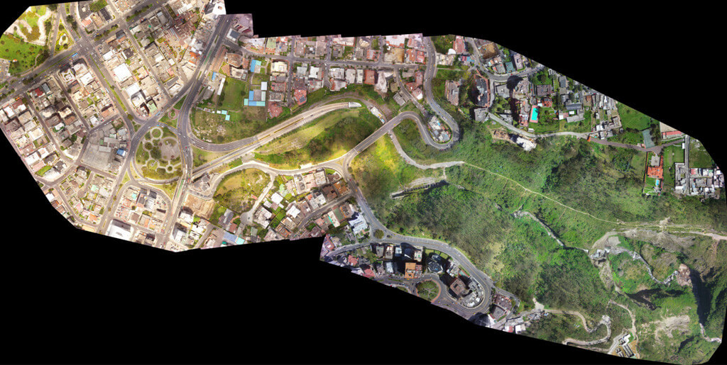
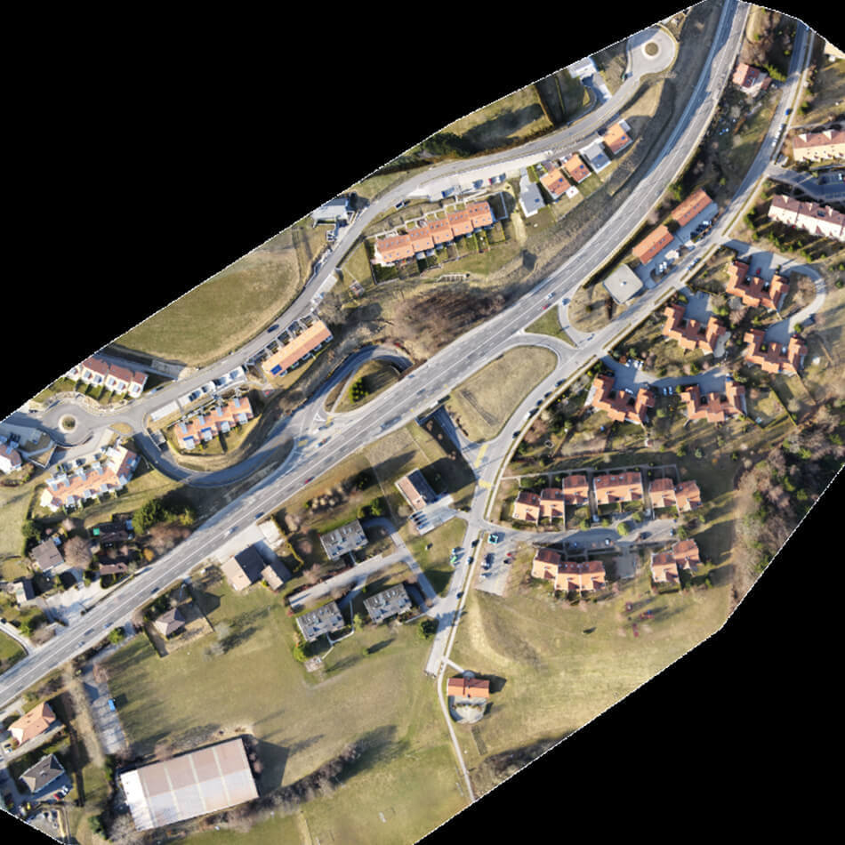
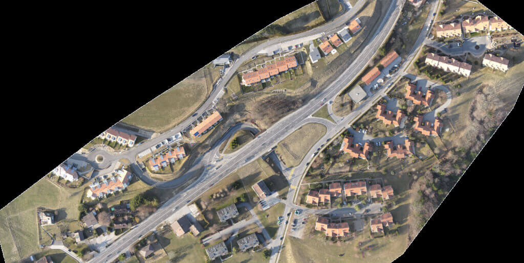
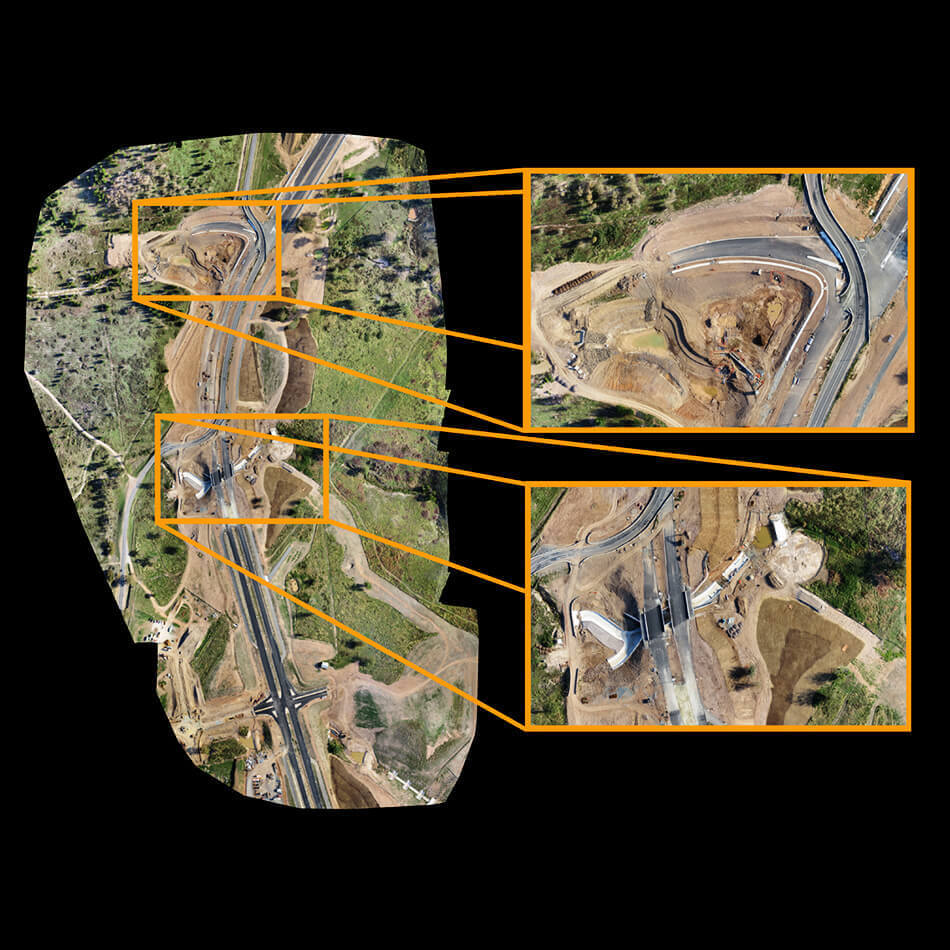
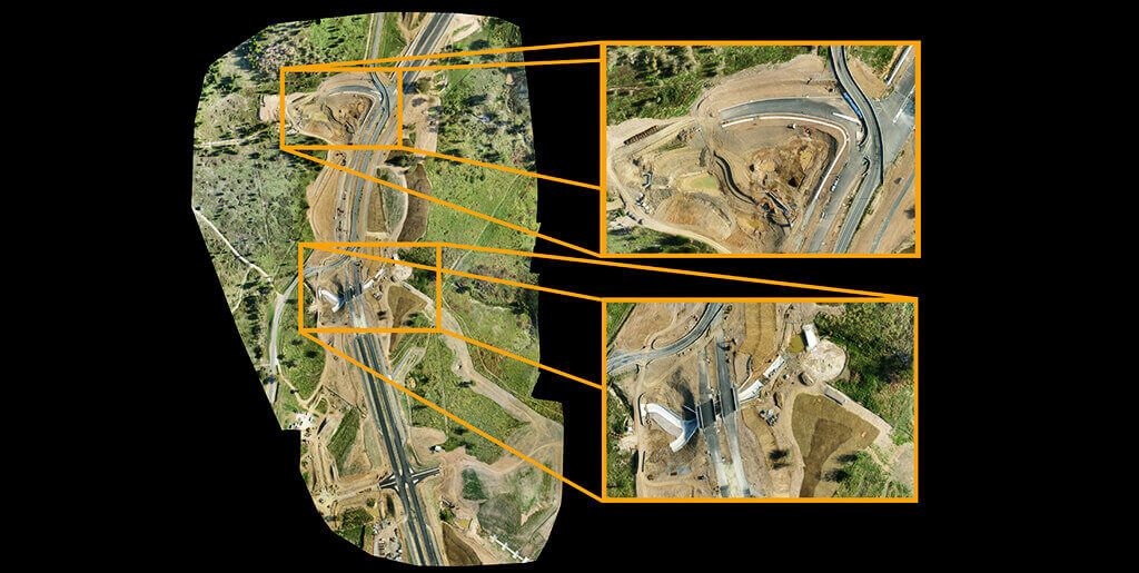
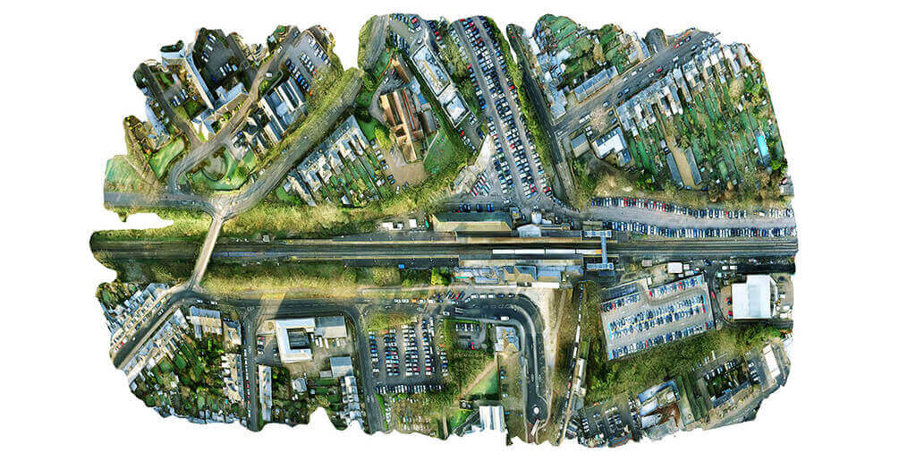
It is a single image output of many images and corrects the resulting mosaic for distortions. Their primary skills are in analyzing features and their timelines and in quickly drawing accurate conclusions by effortlessly stitching multiple images together to create broad area coverage.


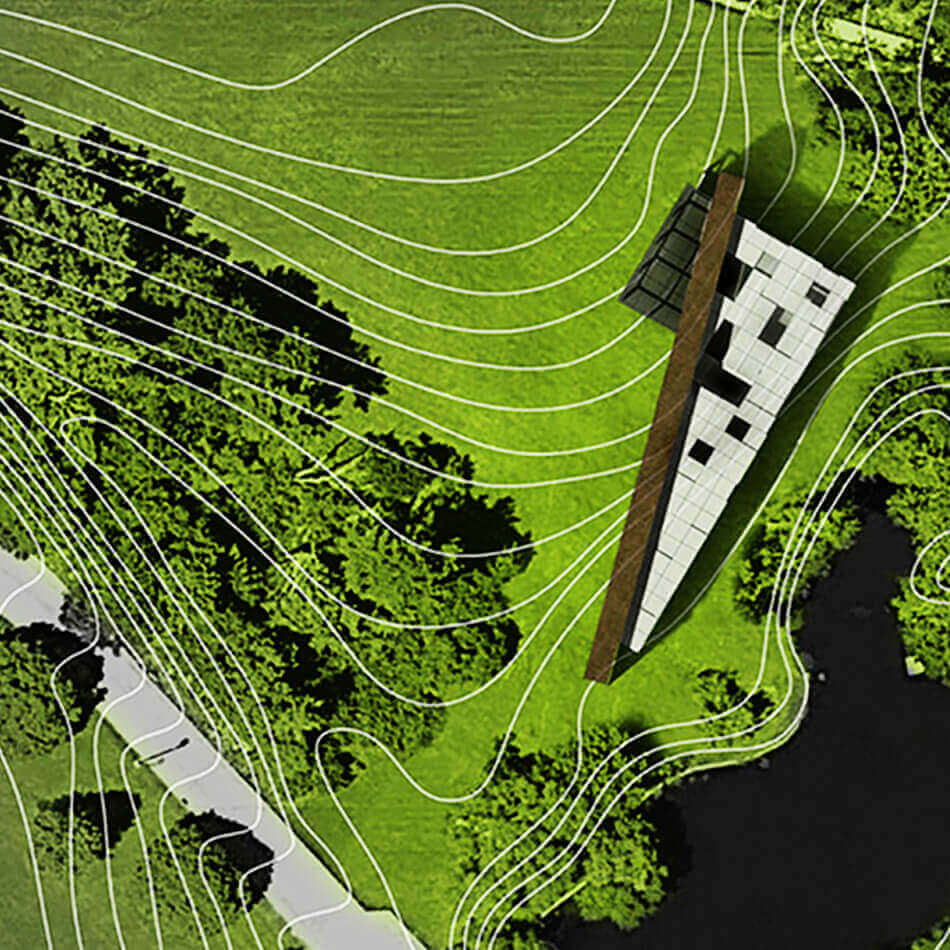
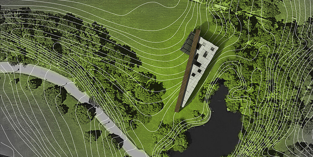
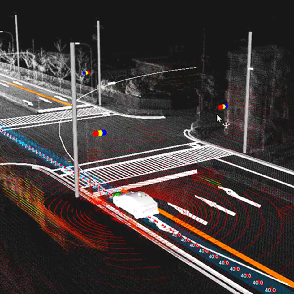
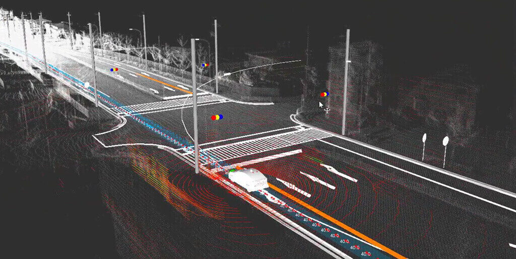
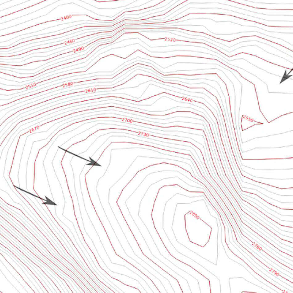
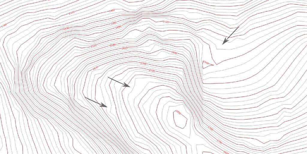
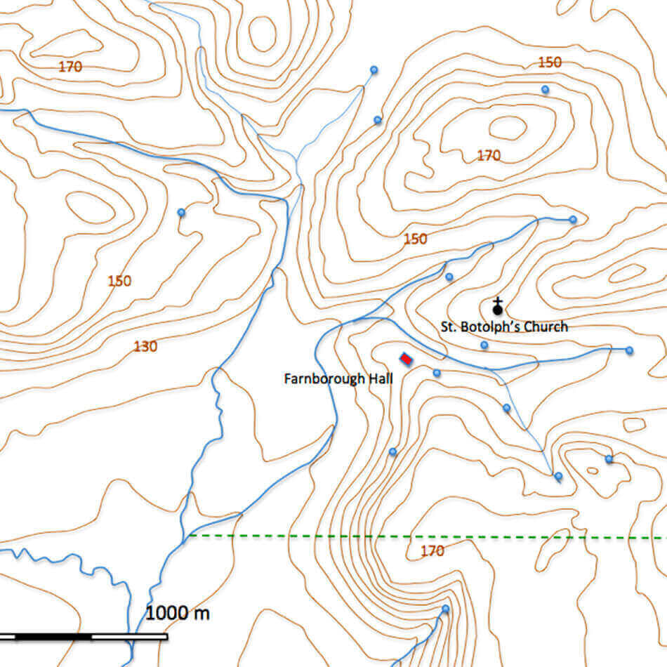
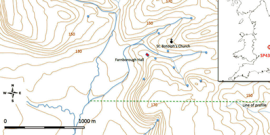
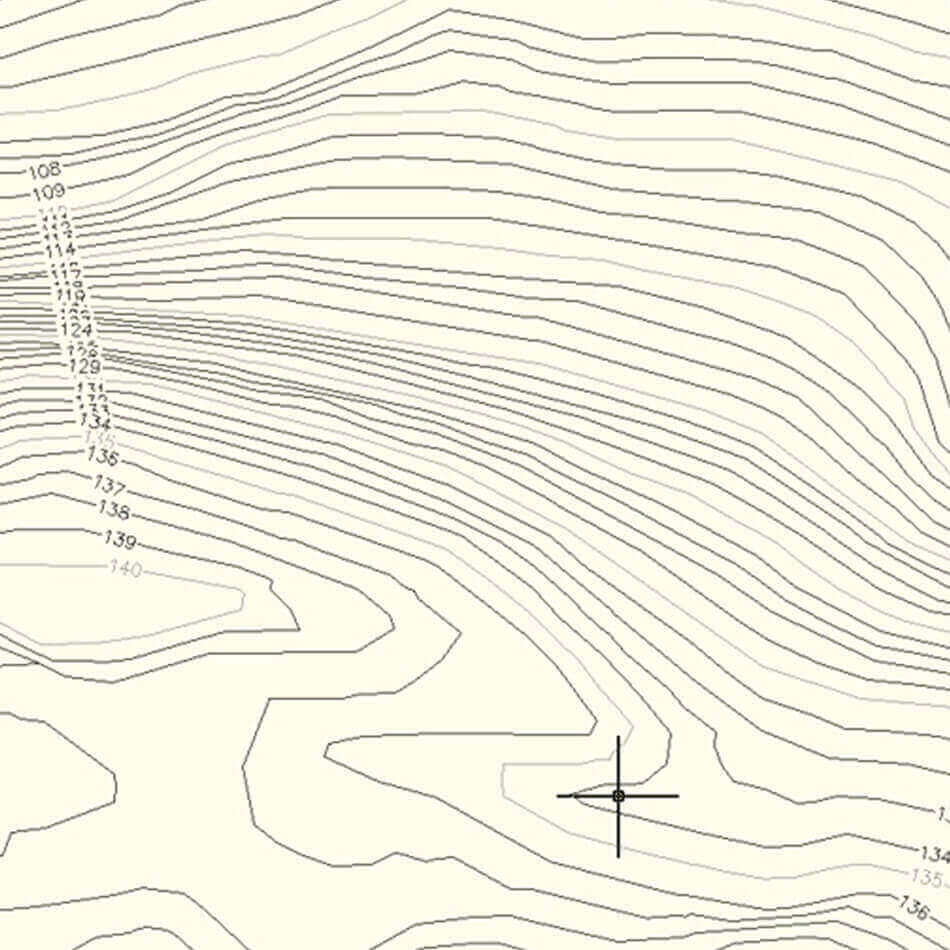
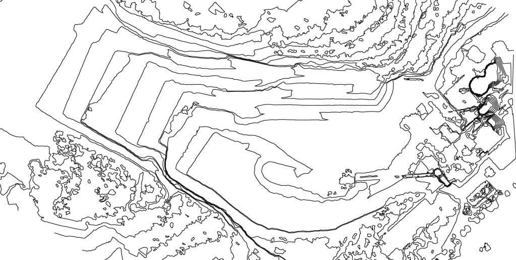
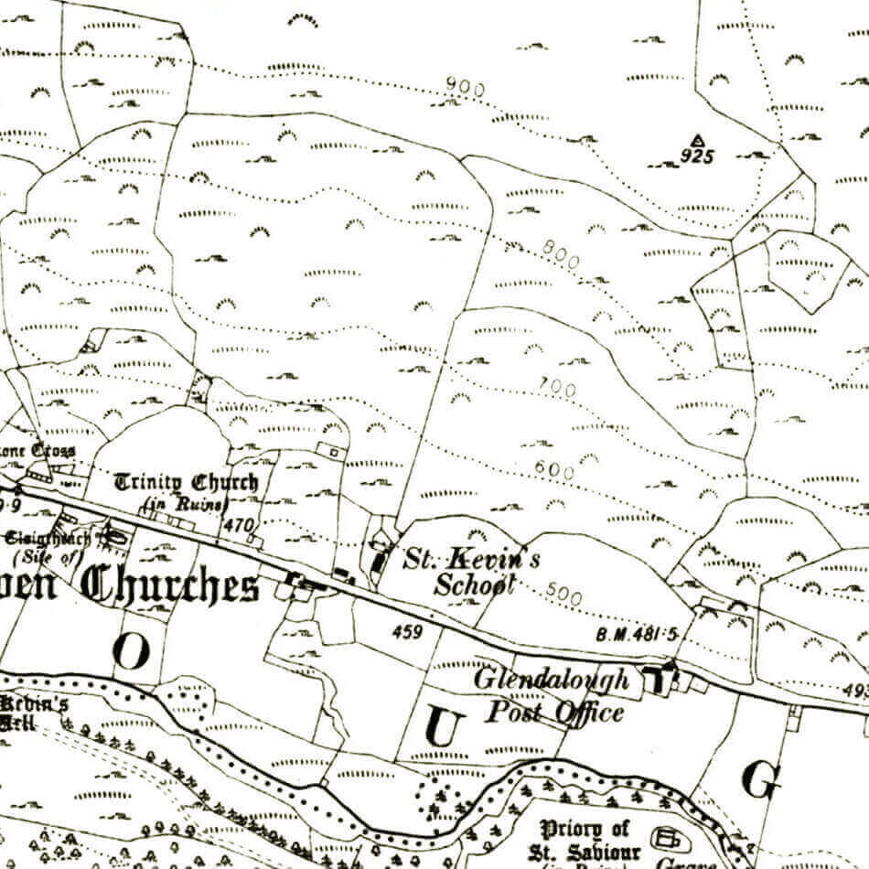
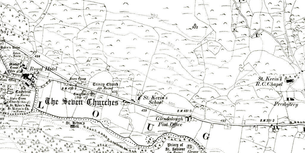
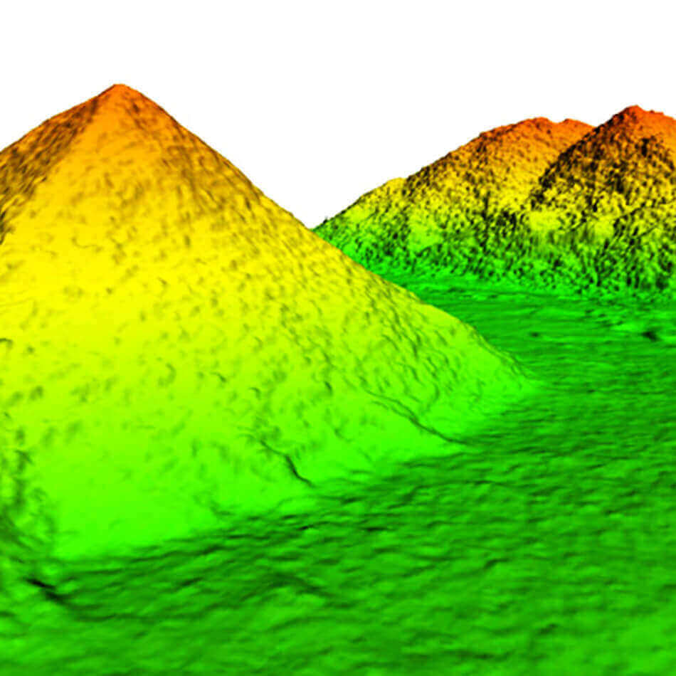
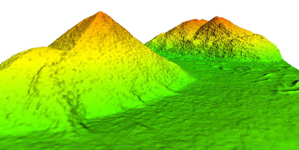
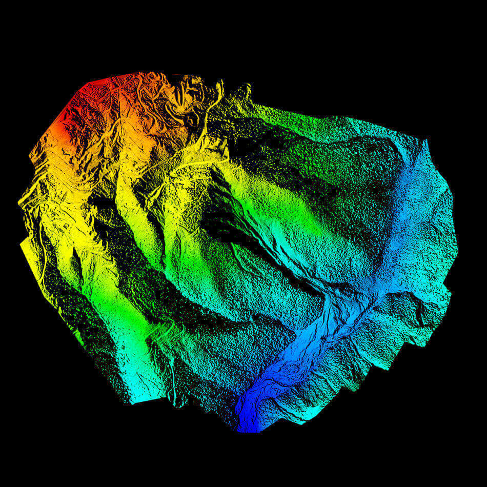
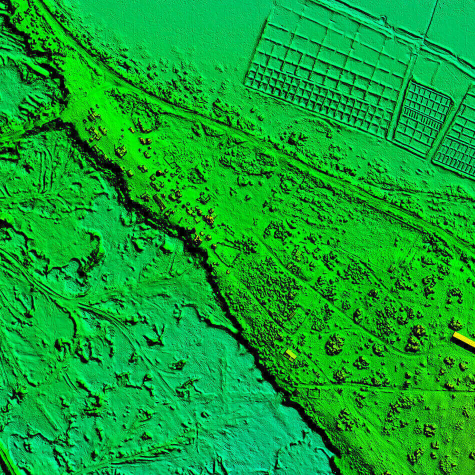
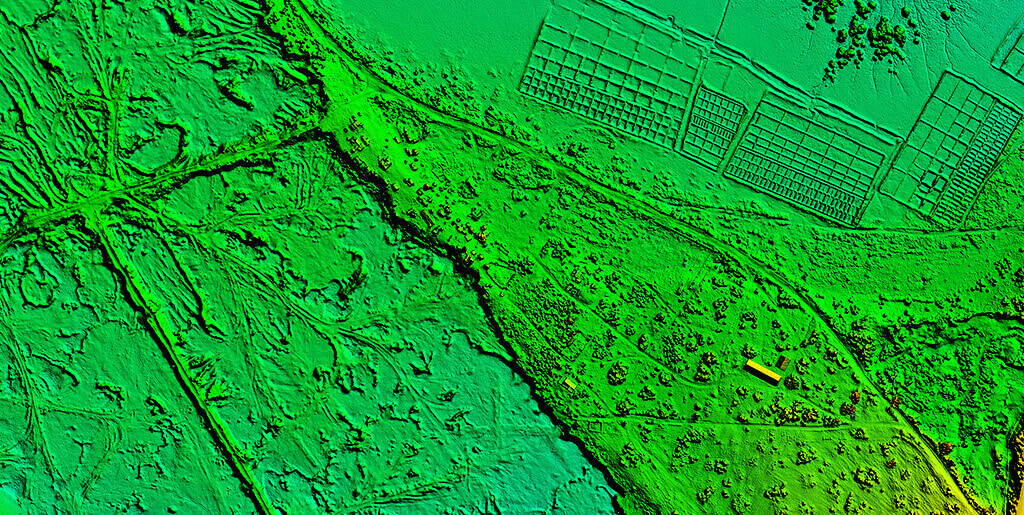
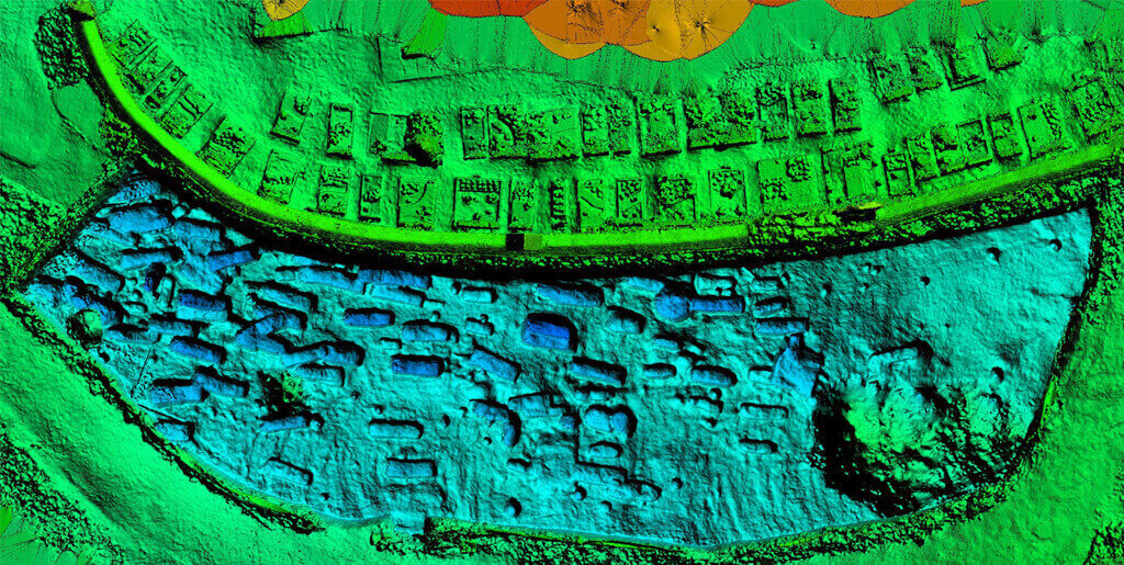
Contours provide valuable information about the nature of terrain. This is very important for selection of sites, determination of catchment area of a drainage basin, to find intervisibility between stations etc.
The configuration of these contours allows map readers to infer relative gradient of a parameter and estimate that parameter at specific places. It can be used to know the nature of the ground and to estimate its slope.


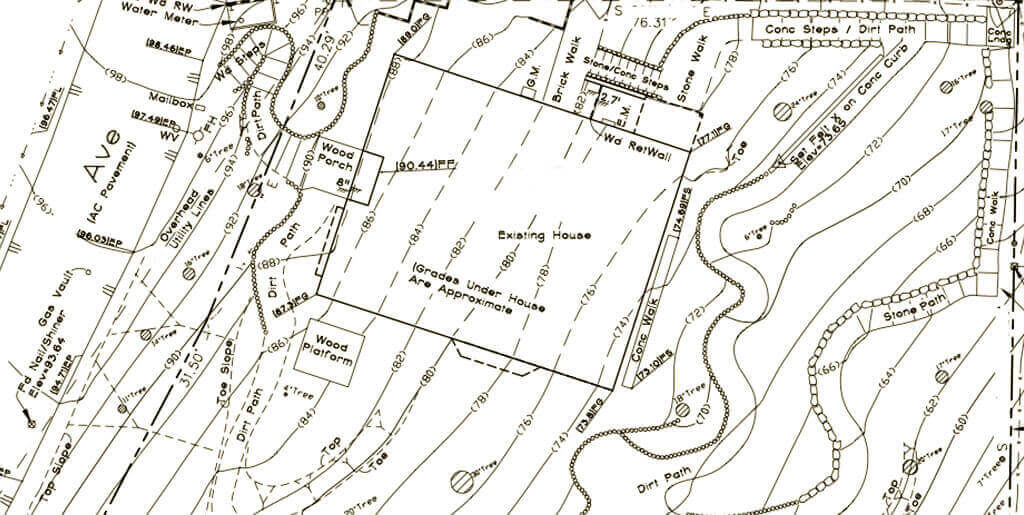
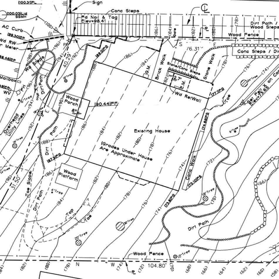
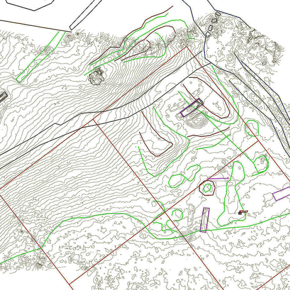
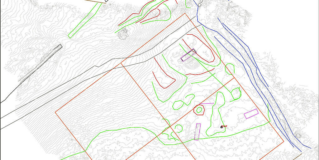
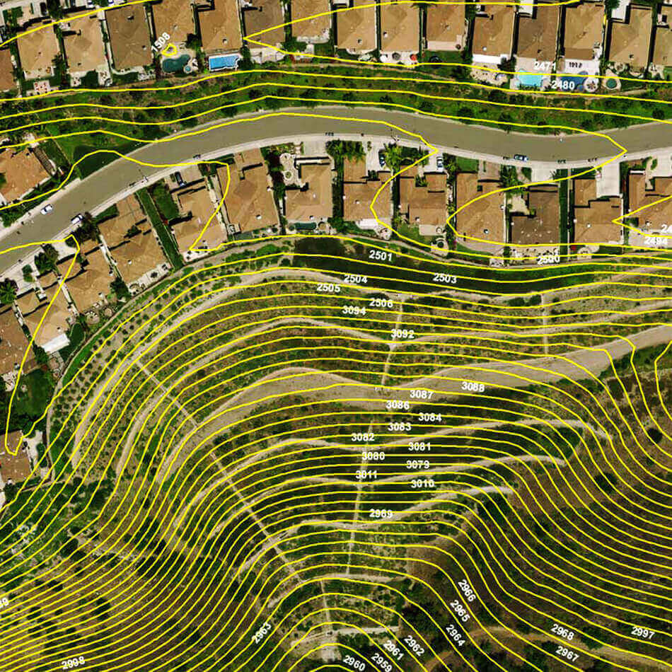
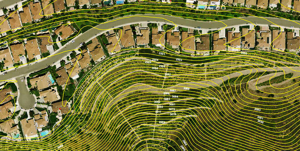
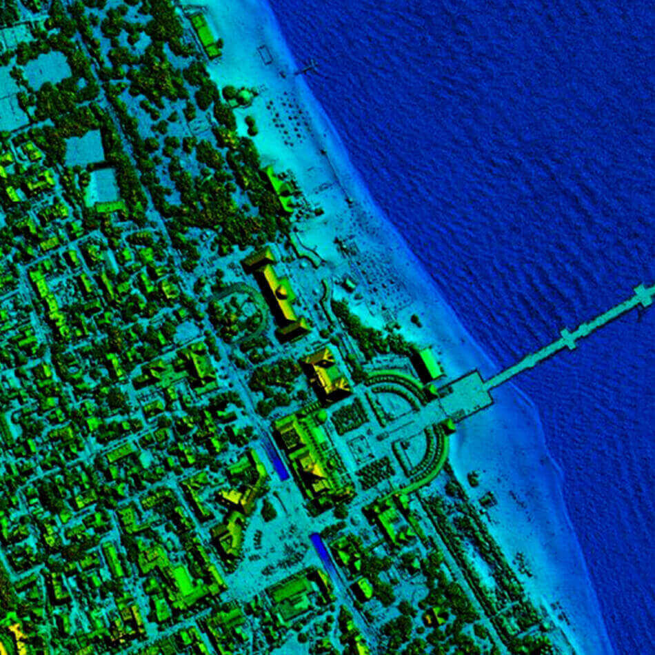
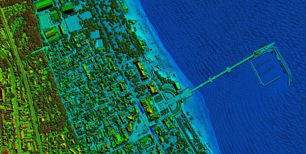
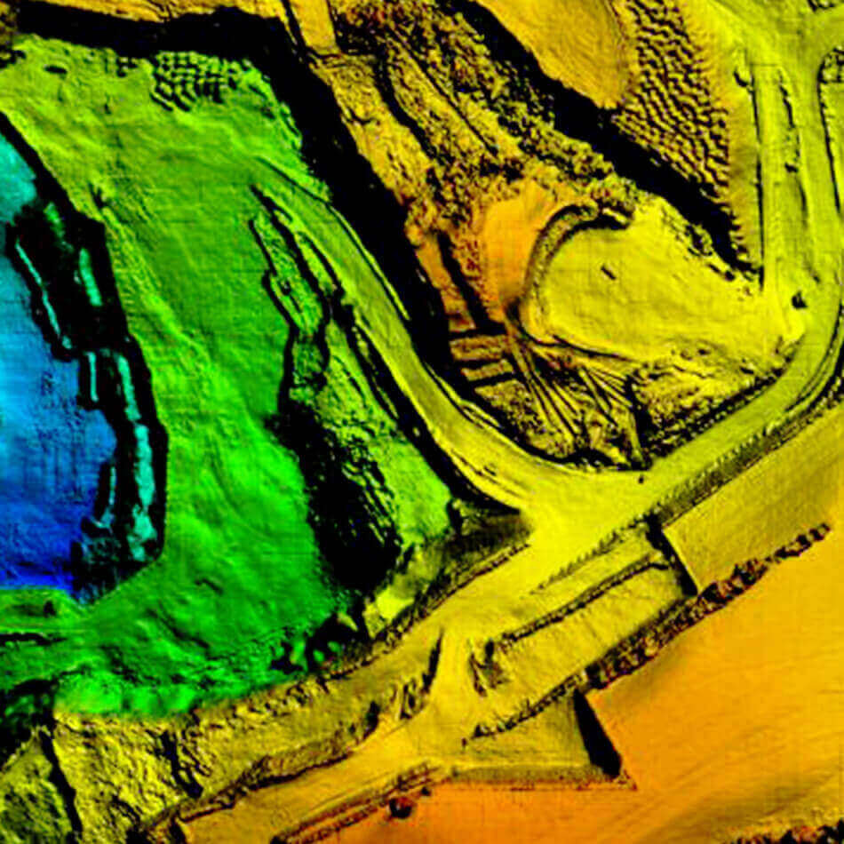
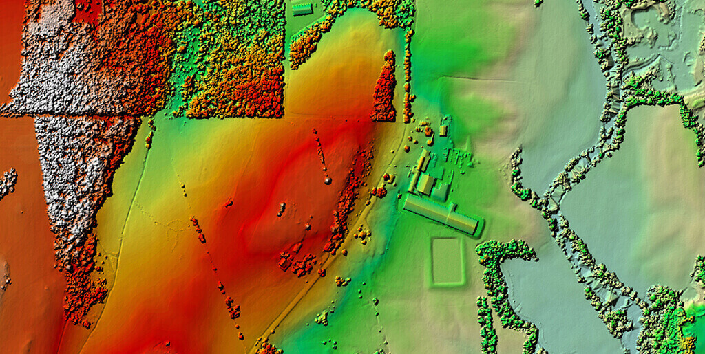
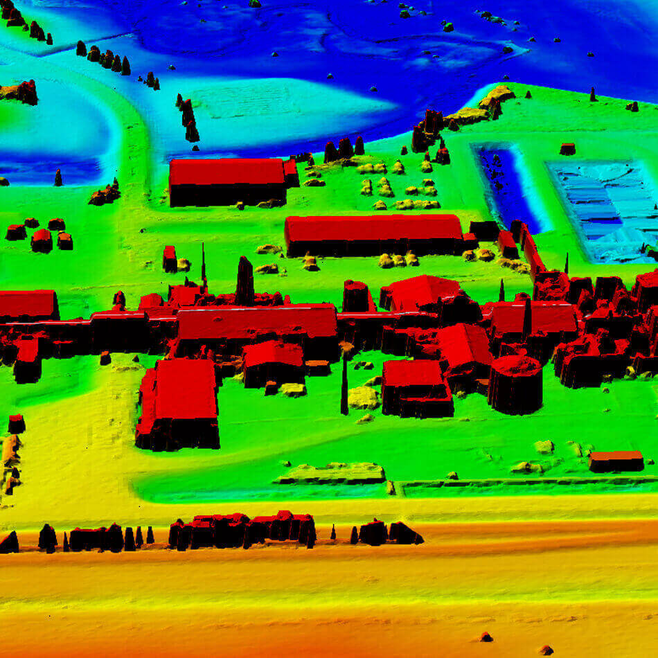
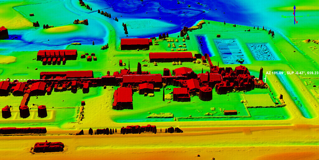
After cleansing the data, Digital Elevation Model and Digital Surface Model is generated. It is used for cut and fill calculations. Its solves purposes like Extracting terrain parameters for geomorphology.
Creation of physical models (including raised relief maps) ,Rectification of aerial photography or satellite imagery, Reduction (terrain correction) of gravity measurements (gravimetry, physical geodesy),Terrain analysis in geomorphology and physical geography, Geographic Information Systems (GIS), Base mapping and many more.


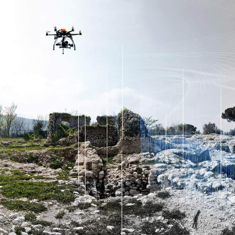
Photogrammetry is used in different fields, such as topographic mapping, architecture, engineering, manufacturing, quality control, police investigation, and geology, as well as by archaeologists to quickly produce plans of large or complex sites.
With GPS-equipped drones, digital cameras and powerful computers, surveys with an accuracy down to 1 to 2 cm is very possible.
1. Measurements- Height,Surface area, any measurement from A to B
2. Volumetric Surveys
3. Contour Lines generation
4. Point cloud classification
5. Plane metric features (road edges, heights, signs, building footprints, surface area , etc)
6. Vectorization
7. 3D Visualisation
8. Ortho-mosaic
9. Digital Terrain Model (DTM)
10. Digital Surface Model (DSM)